Go to...  | Start A New Topic  | Search  | Notify  | Tools  | Reply To This Topic  |  |
"Host" of Barthmobile.com 1/19 1/19 |
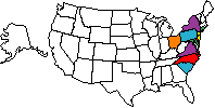
I found this site the other day and thought I would post it.  United States Map  Canada Map You can check off what States or Provinces you have visited and make up your own custom Avatars or add these to your Signature profile. You can select a file format for the map. GIF results look better in smaller file sizes. Three sizes to choose from. Best of all, it's free. Bill  | ||
|
This post is for those who are unfamiliar with Michigan cities and roads. Go to Michigan.gov and type in "View state map online" in the search box. It brings up the state map divided into 9 sections that can be shown in Adobe.pdf format. Of course, adobe format allows you to zoom up any section that you want to highlight. The map has all of the Interstate Highway exits numbered. I don't know if all states have maps online? Jake Jacobson | ||||
|
| Powered by Social Strata |
| Please Wait. Your request is being processed... |
|
This website is dedicated to the Barth Custom Coach, their owners and those who admire this American made, quality crafted, motor coach.
We are committed to the history, preservation and restoration of the Barth Custom Coach.
We are committed to the history, preservation and restoration of the Barth Custom Coach.